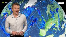
00:00Hello there, good afternoon, welcome to your latest forecast from the Met Office.
00:04High pressure, really dominating our weather pattern at the moment, mist and fog stuck under that area of high pressure,
00:12along with the weather front which is very slowly pushing its way southwards, introducing some cooler conditions,
00:18but largely dry across much of the UK over the coming 24, 48 hours and very similar into next week
00:25as well.
00:26So let's look at the picture for the rest of Saturday.
00:29Once the mist and fog clears, it is slow to clear at this time of the year.
00:33Across England and Wales, there'll be plenty of sunny spells developing.
00:37One or two mist or fog patches may linger, for example, the Vale of York into Lincolnshire,
00:41but the vast majority dry with light winds.
00:44However, that weather front is stuck across Northern Ireland into northwest Scotland, giving some rain here.
00:50A little breezy around the coasts, perhaps across the far east of Northern Ireland,
00:55getting some glimmers of sunshine ahead of the cloud, thickening later.
00:58Similar across southern and eastern Scotland.
01:02And in that sunshine, temperatures lifting well above average for the time of year.
01:0615, 16 Celsius possible in the sunshine, maybe even locally.
01:1017 degrees if we keep any mist and fog in the east.
01:13We'll linger around 11 or 12 degrees.
01:16And under the weather front as well, around 12 or 13 degrees.
01:19So, in that sunshine, feeling very pleasant.
01:23Into the evening time, plenty of dry weather across much of England and Wales,
01:27turning increasingly misty, though, as we move through the evening.
01:31Great for trick-or-treating.
01:32The weather front slips its way slowly southwards as we move through the early hours,
01:37giving some light rain into parts of North Wales, into southern Scotland, Northern England as well.
01:43Some dense fog patches forming across much of England and Wales could lead to some tricky travelling conditions on Sunday
01:51morning.
01:51Clearer skies behind across Norman Island, much of Scotland, though some showers feeding in across the far north west.
01:58So, a chilly night to come, temperatures widely into single figures, a touch of frost possible in sheltered rural areas
02:07under the clearest of skies.
02:09So, for Sunday morning, a grey, misty, foggy start for England and Wales.
02:14This weather front slowly pushes its way southwards through the day, inducing some patchy rain for a time.
02:19The mist and fog in the south lifting to low cloud and then some sunny spells.
02:23And behind the weather front, sunny spells for Northern Ireland, much of Northern England and Scotland.
02:28No one or two showers still feeding around the edge of the high across Northern Scotland.
02:32Winds coming from a northerly direction on Sunday.
02:36So, temperatures down a few degrees in the north, 10 to 12 Celsius.
02:40In the south, 13 to 16 Celsius.
02:44So, some higher temperatures just holding on across southern England for a time.
02:48But even then, the cooler air starting to sink southwards through into the evening time.
02:53One or two heavier bursts are possible.
02:55Parts of East Anglia down to the Wash and then the London area later on on Sunday.
03:00But the vast majority of us having a dry end to the day.
03:05And it looks like into next week, high pressure will be the dominant weather pattern.
03:10Lots of dry weather to come.
03:11Though it often will be quite cloudy.
03:14There will be some sunny spells at times where we see clear skies at night.
03:17Some frost and fog is possible.
03:20And the risk of some showers largely in the south and the east.
03:24And temperatures around average for the time of year.
03:26If you'd like more information on the weather where you are for the rest of the weekend into next week.
03:31You can find more details on our website and our social media channels.
03:36I'll see you again later.